GEOGRAPHICAL INFORMATION SYSTEM (GIS) TRAINING
GIS is a certificate program is a short-term educational program that provides training in geographic information systems (GIS) technology and its applications. The program typically includes courses in GIS software, data analysis, map making, and geospatial database management. Upon completion of the program, students will be equipped with the skills and knowledge necessary to work with geospatial data and to perform GIS-related tasks in various industries, such as urban planning, natural resource management, and business.
COURSES WE OFFER
CERTIFICATE IN GIS
CERTIFICATE IN ARC GIS
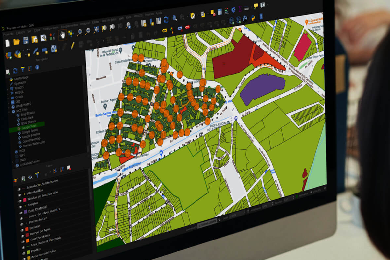
SOFTWARE USED FOR TRAINING

- COURSES DURATION : 3 MONTHS
- MODE OF TRAINING: ONLINE LIVE CLASS